Table of Contents
Auto Level And Total Station, Which Is Better
Auto Level Vs Total Station, Which Is Better may be one of the most common questions asked by aspiring surveyors looking to purchase their first set of surveying instruments. At first glance, these two instruments are very similar, both having the same basic functionality, but do you really need both? Do you have to choose one over the other? In this article, we’ll break down the main differences between the two and help you decide which tool is best suited for your particular needs.
What is an auto level?
An auto level is a surveying instrument used to precisely measure distances, angles and direction. An auto level is an electronic version of a total station that uses a self-leveling bubble vial and laser to take measurements. Since an auto level only shoots out one ray at a time, it is slower than a total station in getting readings. However, you don’t need as much training to use an auto level as you do with a total station and they are easier to carry around.
Learn More About Auto Level From Our Other Blogs.
What are total stations?
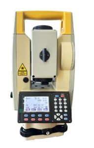
A total station is a surveyor’s instrument used to collect field data and calculate area. This optical device can measure distance along a line and perform different calculations based on that information. It can also be used as a transit to take height measurements (altitude) of an object or structure.
Learn More About Total Station From Our Other Blogs.
Auto Level Vs Total Station
There are so many surveying instruments to choose from and most of them are quite expensive. Because of that there is a lot of confusion when it comes to deciding which instrument should be used for a particular job. Many of us have often wondered how important Auto Levels and Total Stations really are in relation to each other. Are one better than another? In short – yes but not as you may think. While both instruments perform similar functions they do have some crucial differences between them that make one stand out over another depending on what task you will be using them for.
The Different Types of Tilt Meters
Compass & Inclinometer: Like two peas in a pod, compass and inclinometers are portable tools that are used for measuring slope or inclination. There’s quite a bit of overlap between these two tools in terms of functionality but they generally serve different purposes. The compass is most commonly used by surveyors to measure bearings and angles while inclinometers are typically used to measure angles when scoping out construction sites or monitoring land progressions.
How to Choose an Auto Level or a Total Station
Auto Level Vs Total Station are both types of surveying instruments that can help you get an accurate measurement of a location. These tools allow surveyors to gather precise GPS data to create maps and drawings or mark out coordinates in three dimensions. With so many options available, choosing between an auto level and a total station can be tough. Below we outline each product’s benefits and drawbacks to help you make an informed decision on which one is right for your project.


